Sagebrush and Woodland Associations
Description
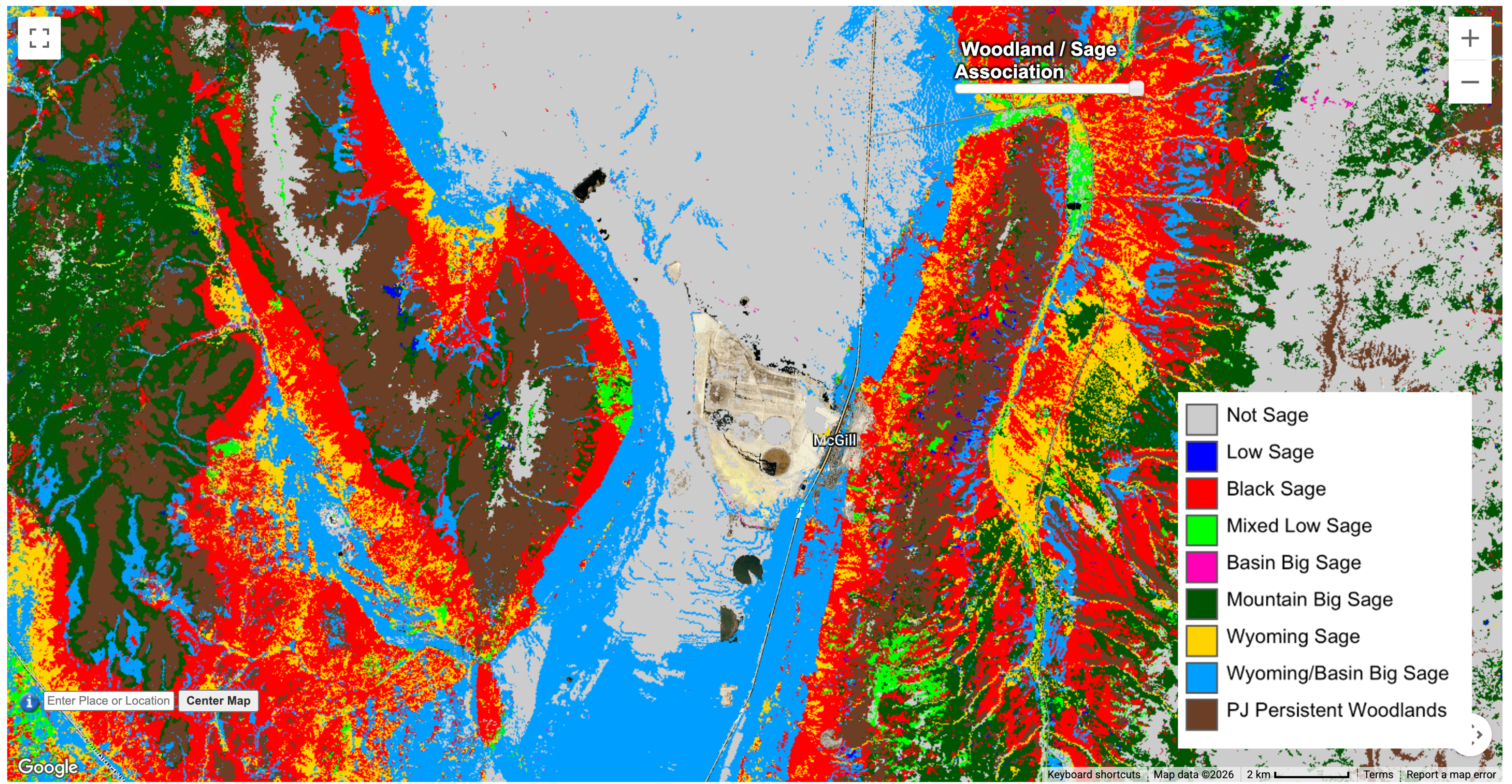
The Sagebrush and Woodland Association dataset combines two spatial products developed by the USDA Forest Service Rocky Mountain Research Station: mapped dominant sagebrush associations and mapped persistent pinyon-juniper woodlands. The resulting layer provides a simplified categorical representation of major sagebrush associations while retaining persistent PJ woodlands as a distinct class.
The dominant sagebrush association dataset was developed for the Snake River Plain, Northern Basin and Range, and Central Basin and Range Level III ecoregions. Sagebrush associations were derived by combining LANDFIRE Existing Vegetation Type, Biophysical Setting, and Mapping Zone information with vegetation plot data from the LANDFIRE Reference Database. The resulting associations include low sagebrush, black sagebrush, mixed low sagebrush, basin big sagebrush, mountain big sagebrush, Wyoming big sagebrush, and combined Wyoming/basin big sagebrush.
Persistent PJ woodlands were identified separately from areas of recent PJ expansion. They represent historical, tree-dominated communities where site conditions and disturbance regimes are inherently favorable for pinyon and/or juniper and where these woodlands were an established landscape component prior to twentieth-century expansion. In the supporting TRG framework, persistent PJ woodlands are treated as high-value resources and are not assigned fuel treatments.
This product available in Climate Engine combines the dominant sagebrush association classes with the persistent woodland class to provide a single 30-meter categorical layer useful for landscape characterization, ecological assessment, and interpretation of treatment-response groups.
Organization
U.S. Department of Agriculture, Forest Service, Rocky Mountain Research Station (USDA Forest Service RMRS)
Website
Link to sagebrush associations dataset on U.S. Forest Service Research Data Archive https://www.fs.usda.gov/rds/archive/catalog/RDS-2024-0006
Link to pinyon juniper expansion areas and persistent woodlands dataset on U.S. Forest Service Research Data Archive https://www.fs.usda.gov/rds/archive/catalog/RDS-2024-0007
Terms of Use
The source datasets were collected using U.S. Government funding and may be used without additional permissions or fees. Users should cite the applicable Forest Service Research Data Archive datasets and the supporting publication when using or interpreting this combined Climate Engine layer. (CHECK ON THIS)
References
Chambers, J. C., Brown, J. L., Reeves, M. C., Strand, E. K., Ellsworth, L. M., Tortorelli, C. M., Urza, A. K., & Short, K. C. (2023). Fuel treatment response groups for fire-prone sagebrush landscapes. Fire Ecology, 19, 70. https://doi.org/10.1186/s42408-023-00230-2
Chambers, J. C., Brown, J. L., Reeves, M. C., Strand, E. K., Ellsworth, L. M., Tortorelli, C. M., Urza, A. K., & Short, K. C. (2024). Dominant sagebrush associations of the Snake River Plain, Northern Basin and Range, and Central Basin and Range Level III ecoregions in the western United States. Fort Collins, CO: Forest Service Research Data Archive. https://doi.org/10.2737/RDS-2024-0006
Chambers, J. C., Brown, J. L., Reeves, M. C., Strand, E. K., Ellsworth, L. M., Tortorelli, C. M., Urza, A. K., & Short, K. C. (2024). Pinyon and juniper expansion areas and persistent woodlands in the Snake River Plain, Northern Basin and Range, and Central Basin and Range Level III ecoregions in the western United States. Fort Collins, CO: Forest Service Research Data Archive. https://doi.org/10.2737/RDS-2024-0007
Note:
-
Not Sage #CCCCCC
-
Low Sage #0000FF
-
Black Sage #FF0000
-
Mixed Low Sage #00FF00
-
Basin Big Sage #FF00B6
-
Mountain Big Sage #005300
-
Wyoming Sage #FFD300
-
Wyoming/Basin Big Sage #009FFF
-
PJ Persistent Woodlands #6B3E26