CHIRPS Prelim - 4.8km - Pentad
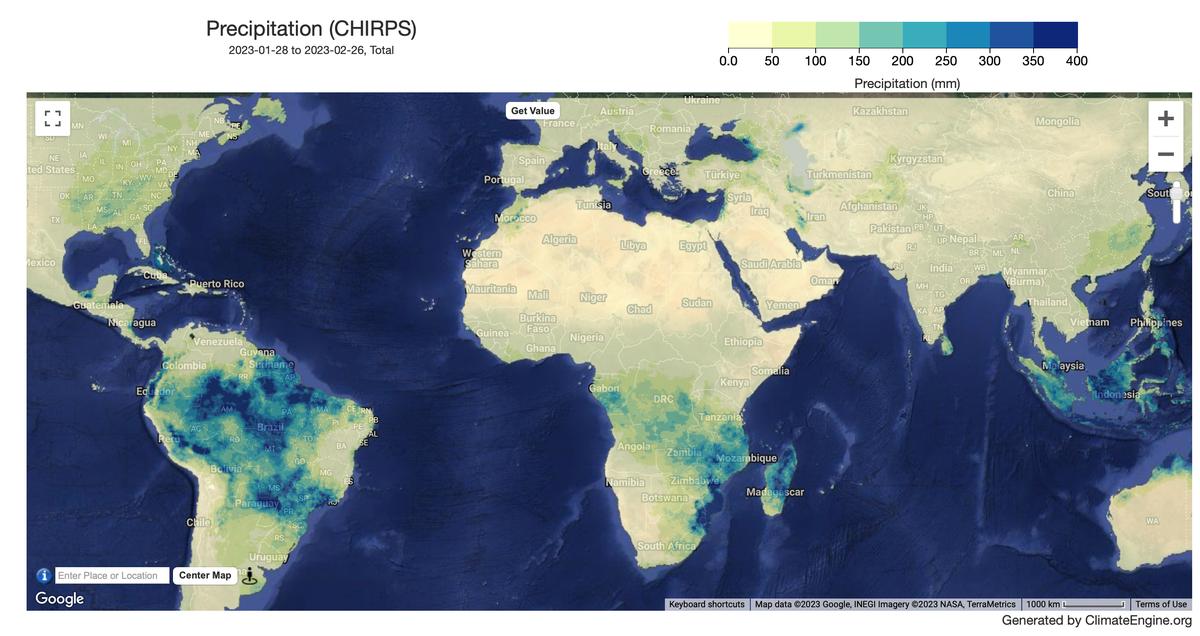
Example 1-month Precipitation Map
Description
The Climate Hazards Center Infrared Precipitation with Stations version 3 Preliminary (CHIRPS v3 Preliminary) blends CHIRP3, a satellite-based thermal infrared rainfall estimate, with in situ station observations to reduce bias and improve accuracy. It is produced in a similar way to the CHIRPS v3 final product. The main difference is that the preliminary product relies on rapidly updated station observations, while the final product blends in the best available station inputs. This allows CHIRPS v3 Preliminary to be released 2 days after the end of each pentad (on the 2nd, 7th, 12th, 17th, 22nd, and 27th day of each month). The CHIRPS v3 final product is produced once a month, typically in the third week of the following month.
Climate Engine details
- Dataset type
- Climate/Hydrology
- Climate Engine ID
- CHIRPS_PRELIM_PENTAD
- Documentation
- No link provided
Dataset details
- Scale
- 4.8km
- Frequency
- Pentad
- Coverage
- Global
- Start year
- 2015
- End year
- Present
Earth Engine collection details
- Earth Engine asset
- projects/climate-engine-pro/assets/ce-chirps-prelim-pentad
- Earth Engine source catalog
- ClimateEngine.org
Variables
API variable docs: #chirps-preliminary-pentad
| Name | Units |
|---|---|
| Precipitation | mm |
| Standardized Precipitation Index (SPI) | N/A |
References
- Funk, C., Peterson, P., Harrison, L. et al. The Climate Hazards Center Infrared Precipitation with Stations, Version 3. Sci Data 13, 718 (2026). https://doi.org/10.1038/s41597-026-07096-4
Website: https://www.chc.ucsb.edu/data/chirps
Terms of use
CHIRPS3 is in the public domain, as registered with Creative Commons, and is licensed under a Creative Commons Attribution 4.0 International License . To the extent possible under the law, the Climate Hazards Center has waived all copyright and related or neighboring rights to CHIRPS3. This work is published from the United States.