CHIRPS - 4.8km - Pentad
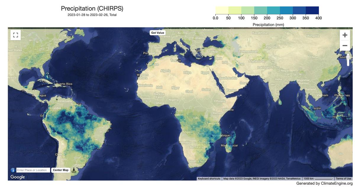
Example 1-month Precipitation Map
Description
The Climate Hazards Center Infrared Precipitation with Stations version 3 (CHIRPS v3) is a 40+ year quasi-global rainfall data set. Spanning 60 degS-60 degN (and all longitudes) and ranging from 1981 to near-present, CHIRPS v3 incorporates an updated in-house climatology, CHPclim2, satellite-based thermal infrared rainfall estimates, and in-situ station data to create 0.05 deg gridded rainfall time series over land. CHIRPS v3 is produced by the Climate Hazards Center at the University of California Santa Barbara.
Climate Engine details
- Dataset type
- Climate/Hydrology
- Climate Engine ID
- CHIRPS_PENTAD
- Documentation
- No link provided
Dataset details
- Scale
- 4.8km
- Frequency
- Pentad
- Coverage
- Global
- Start year
- 1981
- End year
- Present
Earth Engine collection details
- Earth Engine asset
- UCSB-CHC/CHIRPS/V3/PENTAD
- Earth Engine asset URL
- https://developers.google.com/earth-engine/datasets/catalog/UCSB-CHC_CHIRPS_V3_PENTAD
- Earth Engine source catalog
- Earth Engine Catalog
Variables
API variable docs: #chirps-pentad
| Name | Units |
|---|---|
| Precipitation | mm |
| Standardized Precipitation Index (SPI) | N/A |
References
- Funk, C., Peterson, P., Harrison, L. et al. The Climate Hazards Center Infrared Precipitation with Stations, Version 3. Sci Data 13, 718 (2026). https://doi.org/10.1038/s41597-026-07096-4
Website: https://www.chc.ucsb.edu/data/chirps
Terms of use
CHIRPS3 is in the public domain, as registered with Creative Commons, and is licensed under a Creative Commons Attribution 4.0 International License . To the extent possible under the law, the Climate Hazards Center has waived all copyright and related or neighboring rights to CHIRPS3. This work is published from the United States.